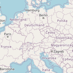
Welcome to the section dedicated to the geography of the European continent. Here is a detailed political map of Europe, designed for a detailed study of the administrative structure of the region. This tool allows you to view European countries in high resolution, providing quick access to up-to-date geographical data.
Europe is a unique part of the world with a high density of states and a complex history of territorial formation. Our map clearly shows European countries with borders, allowing you to visually assess the size and proximity of various powers. You can easily trace the lines of demarcation between states and understand the political structure of the continent. The clear drawing of contours makes it easier to study European states convenient and visual.
To fully analyze geography, it is not enough to know only the contours of countries. This scheme is completed with capitals and large settlements. When zooming in, smaller objects with cities of significant administrative or cultural significance become available. All objects are marked with names, which eliminates confusion and helps you quickly find the right locations in Europe.
The interactive format provides the user with a number of advantages when working with European data:


